InTDS ArchivebyMy Data TalkFolium and Choropleth Map: From Zero to ProA Step-by-Step Tutorial to Create an Interactive Choropleth Map Using Folium with Layer Control and Customized TooltipsJan 4, 20226Jan 4, 20226
InTDS ArchivebyJuan NathanielGeopandas Hands-on: Building Geospatial Machine Learning PipelineMay 12, 2021May 12, 2021
AbdishakurRouting street networks: Find your way with PythonTutorial — Getting Direction routes with Python and route animationsJun 4, 20201Jun 4, 20201
Jan DegenerConvert 10,000,000 addresses into coordinatesBy running your own Nominatim server locallyNov 25, 2022Nov 25, 2022
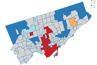
InTDS ArchivebyPeng WangExploratory Spatial Data Analysis (ESDA) — Spatial AutocorrelationExplores Toronto neighborhoods Airbnb listing prices and identifies hot/cold areasJan 4, 2021Jan 4, 2021
InAnalytics VidhyabyAdeoluwa AdeboyeData Visualization: Deploying an Interactive Map as a Web App with HerokuThis articles will attempt to share insight on how to deploy an interactive map visualization using Folium, Flask and Heroku. It is a…Dec 20, 20201Dec 20, 20201
InTDS ArchivebyParul PandeyInteractive Geographical maps with GeoPandasExplore the geospatial data with interactive visualizationsNov 10, 20214Nov 10, 20214
InTDS ArchivebyAlberta Odamea Anim-AyekoYour Cool Folium Maps on the WebLeveraging flask and heroku to share your interactive maps with the worldMar 13, 20211Mar 13, 20211